The Suwannee River begins in southern Georgia, in the Okefenokee Swamp. It flows south into Florida where it snakes around and gets bigger and bigger before it flows into the Gulf of Mexico, 266 miles from where it began. Several other rivers and springs flow into the Suwannee both in Georgia and Florida. From Georgia, some major tributaries are the Alapaha and Withlacoochee Rivers. They begin in Georgia and join the Suwannee in Florida. These are the two rivers that saw record floods this year in April and caused the last major flood here at Troy. Further south on the river from Troy Springs, the Santa Fe River joins the Suwannee. The Santa Fe is mostly spring fed and includes the spring water from the Ichetucknee River. This map of the Suwannee River Basin will give you a good idea of the huge area that affects the Suwannee. If rain falls anywhere within that area, some rain will be absorbed into the soil, but much of it will work its way through those water ways and down the Suwannee River. Troy Springs is in the northern part of Lafayette County on that River Basin map. To sum it up, if the weather report is calling for excessive rain in south Georgia along I-75 south of Perry, in Valdosta, or near the Okefenokee Swamp, I will see it go by the park in three to seven days. Excessive rain in Columbus, Macon, Augusta or Atlanta will flow elsewhere, either directly to the gulf through Georgia or east to the Atlantic.
The other half of the water level equation at Troy is groundwater flowing out of the Floridan Aquifer at the spring which flows out to the river. The aquifer is a lot like water logged Swiss cheese or a saturated sponge. The porous and easily eroded limestone that is beneath the soil in much of Florida has intricate pathways where water can flow. The water enters the aquifer from rain which falls and filters through the soil and limestone, or from larger openings where areas of rock have opened up to form sink holes. Water exits the aquifers at springs, public and private wells, and water bottling plants. Local rain in what is referred to as the spring-shed will recharge the area of the aquifer that feeds Troy Springs. Its a little harder to define a spring-shed as compared to a river basin because the spring-shed pathways are all under ground. Specially trained SCUBA divers and dye-trace studies can tell us a lot about the pathways that the water takes, but we definitely can't see the whole picture just yet.
Troy Spring pumps out an average of 90 million gallons of water each day. That amount does fluctuate, based on the amount of water in the aquifer that is available to feed Troy Spring. If we are in a drought, locally or if there is a high demand on water from wells, the spring will put out less flow. If we have had a great deal of local rain, or if people are not using much well water, we have a better flow. Its just like trying to take a shower in a busy home. If someone is running the dishwasher and a hose outside, your shower will have less pressure or contrastingly, if no one else is using the water, your shower will have more pressure.
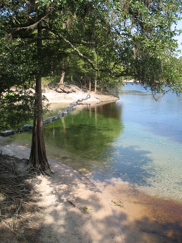
A picture that I show you often, illustrates the constant push and pull that exists between the dark, tannic river water and the clear spring water. If the river level is high, you will see the river water pushing into the spring run. If the river level is low, the spring can push way out into the river. The amount of flow from the spring can move this line around as well as the river level. Because of these two factors, we can't really say exactly how the water will look at any given water level. In the three years that I have been at Troy, I have seen the tannic river water completely overtake the spring and cause a brown out anywhere from 11 feet above sea level to 13 feet. We have gathered some historic information from divers who visited many years ago by using land marks and water depth from their dive logs. We can see that in the past, when there was less demand on the aquifer, a brown out at Troy Spring would happen when the water was much higher.
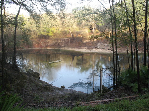
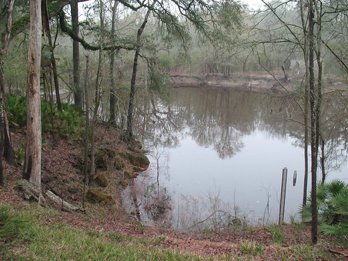
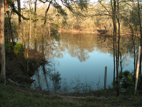
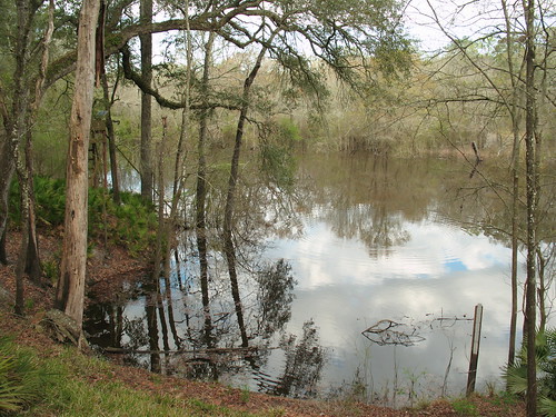
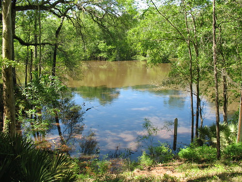
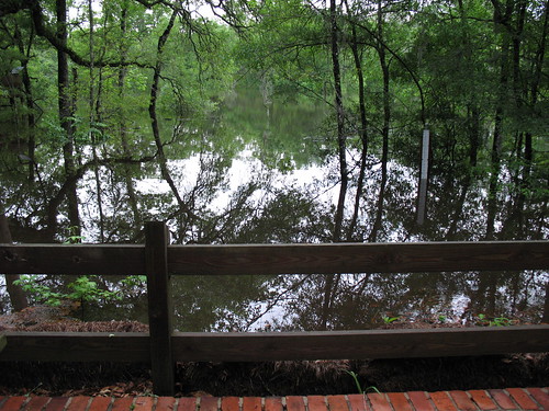
So that is the delicately balanced system that keeps my job teetering back and forth between having park visitors and having just a few people stop by every once in a while to see how high the river is. Because I haven't shared any photos today, here are some shots from previous floods at Troy. These were all taken from the porch of the cabin but they are at different points in time throughout the past 3 years.


2 comments:
Wow... those pictures are great, what a service you are doing for the history of you park with your pictures...you rock!
Glad to hear your arm is healing, Amy!
Post a Comment